Software designed for
the future of data management
GIM Suite 5.1 boosts the powerful features introduced in GIM Suite 5, bringing the future of geological data management to today’s mining workplace.
Database managers can take advantage of enhanced web-based administration, helping you speed up workspace and task configuration times to seamlessly deploy to field geology teams.
Geological field data collection across web and mobile has been enhanced with the introduction of personalised graphical logging layouts and settings to suit geologists’ individual logging styles.
Our continual focus on evolving GIM Suite ensures you are working with the leading software for geological data management and investing in your future technology road map.
 '
'
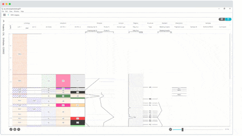
Even more streamlined field data collection
In GIM Suite 5, we introduced a purpose-built interface designed for drillhole logging and sampling across a range of scenarios in web and mobile. In GIM Suite 5.1, we’ve made further improvements streamlining your field data collection processes.
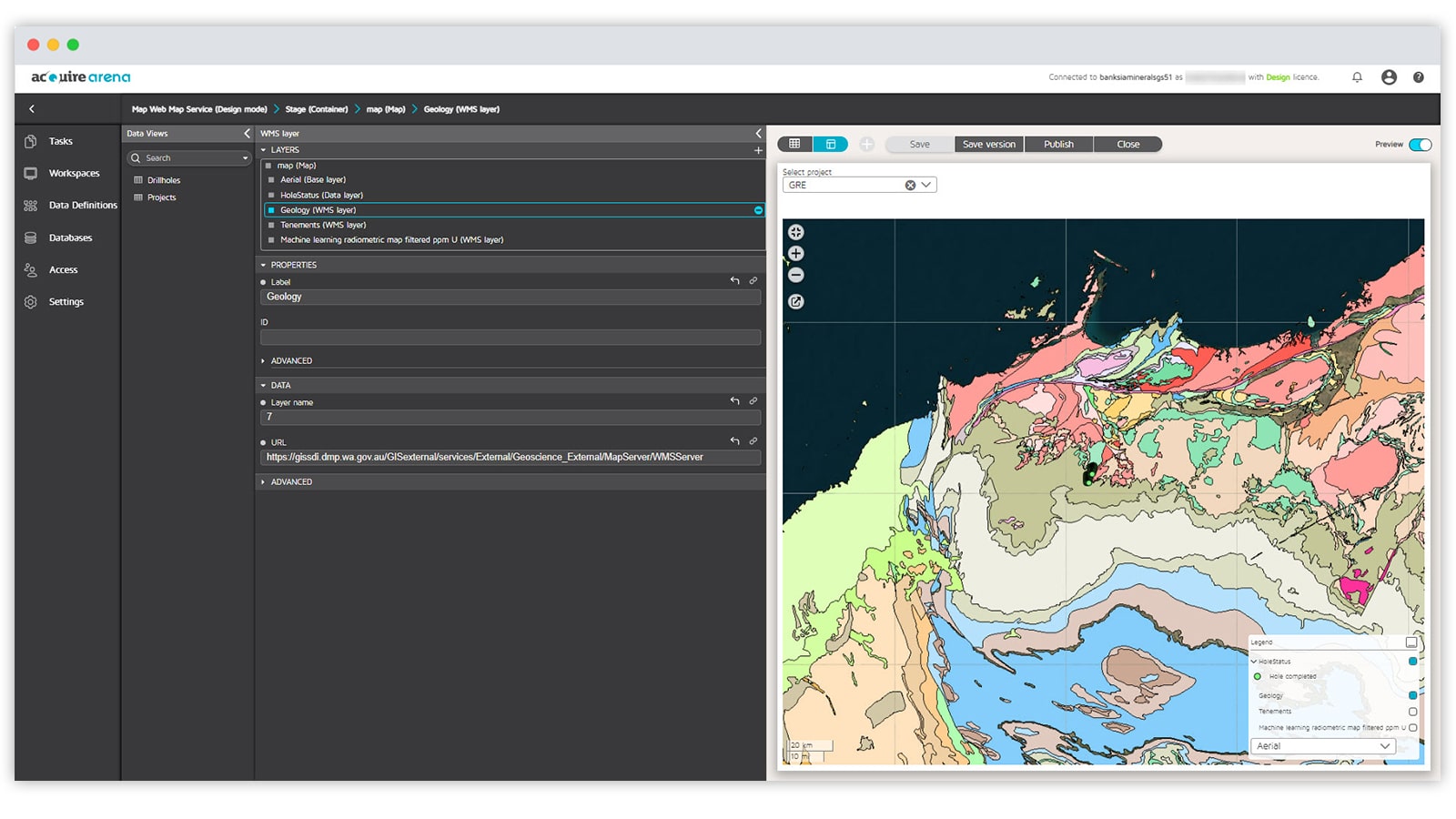
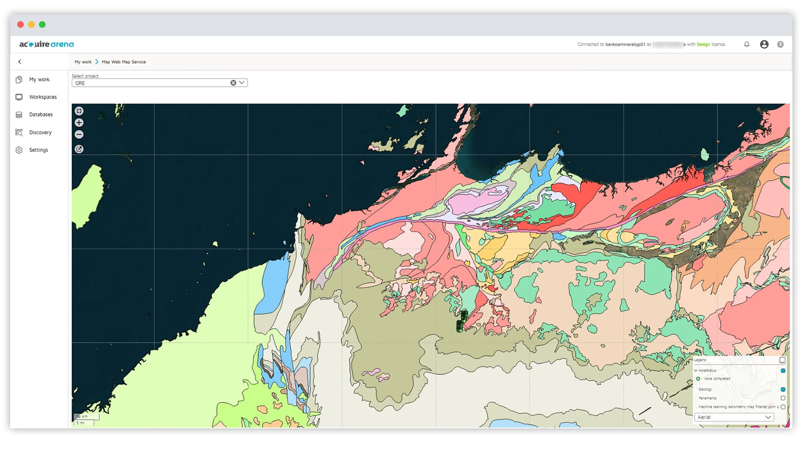
Add WMS layers to GIM Suite’s web interface
Gain better spatial context and awareness from visual cues like tenement boundaries, drill pad locations or satellite imagery. Project-specific, high-res GIS maps can be configured as a Web Map Service (WMS) layer in GIM Suite’s web interface to improve workflow efficiency.
 '
'
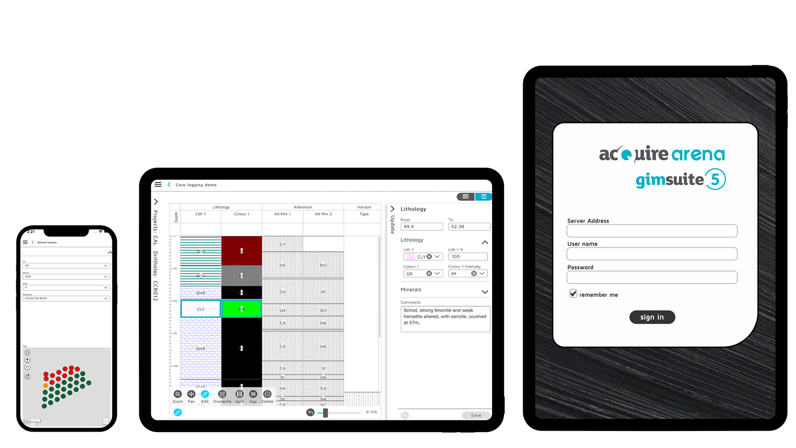
Flexibility to choose your preferred mobile device
GIM Suite’s mobile app gives you the flexibility to use your preferred device for collecting drillhole data in remote or offline environments. It now includes support for Windows operating systems, along with Android and iOS, and different device types, including smartphones and tablets.
![]()
![]()
 '
'
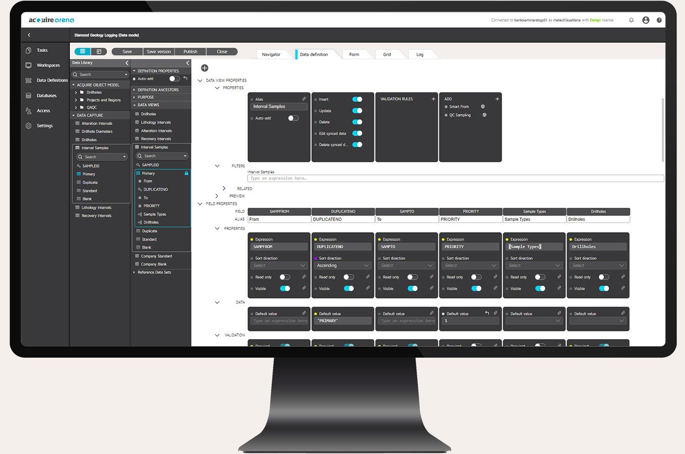
Enhanced web-based administration
Reduce unnecessary disruptions to users and your operations when updating and managing web-based dataset rules and configurations.
With GIM Suite 5.1, database managers can work in draft mode when testing and updating settings, without affecting users who are simultaneously working on live workspaces. When creating tasks in the Arena software component, data definitions provide rules and configurations. Those tasks are now updated only when your rules and settings are published to your central library.
You can have confidence that your teams are working on the same, published workspace or task version, which reduces duplications. You can also take advantage of task versions and history to roll back any changes you’ve made. All these improvements are designed to help database managers speed up configuration times and reduce operational downtime for teams, while maintaining maximum data quality and integrity across your solution.
Make smarter decisions with your data using software designed for the future of data management.
Start your upgrade to GIM Suite 5.1 today